
The Federal, State and County highways of Crawford County:

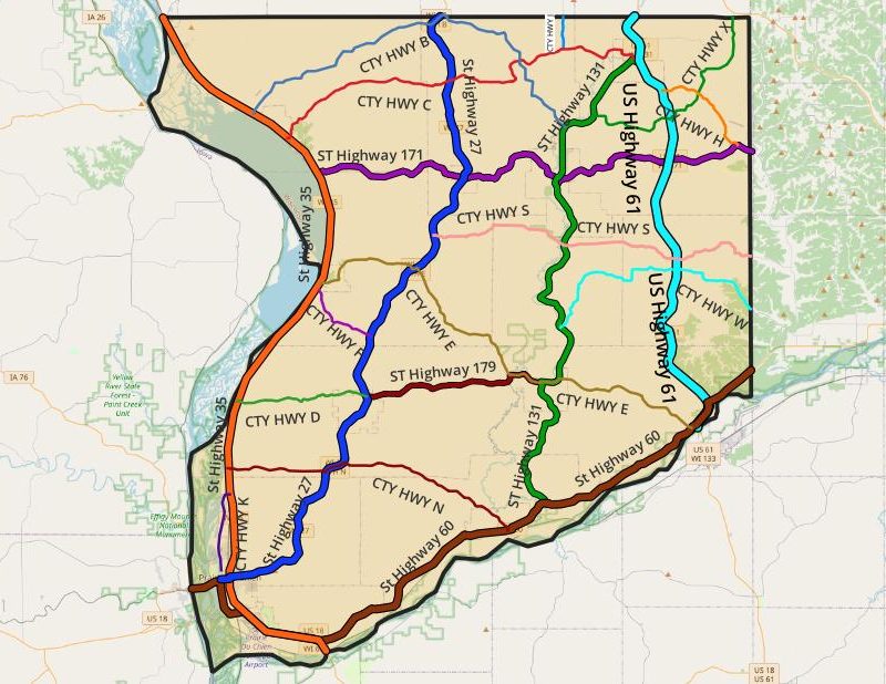
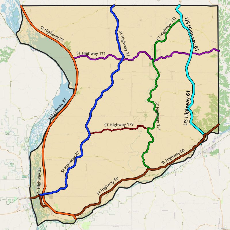
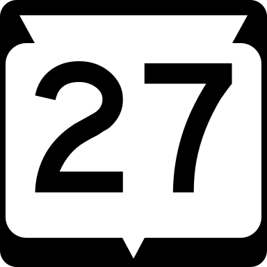
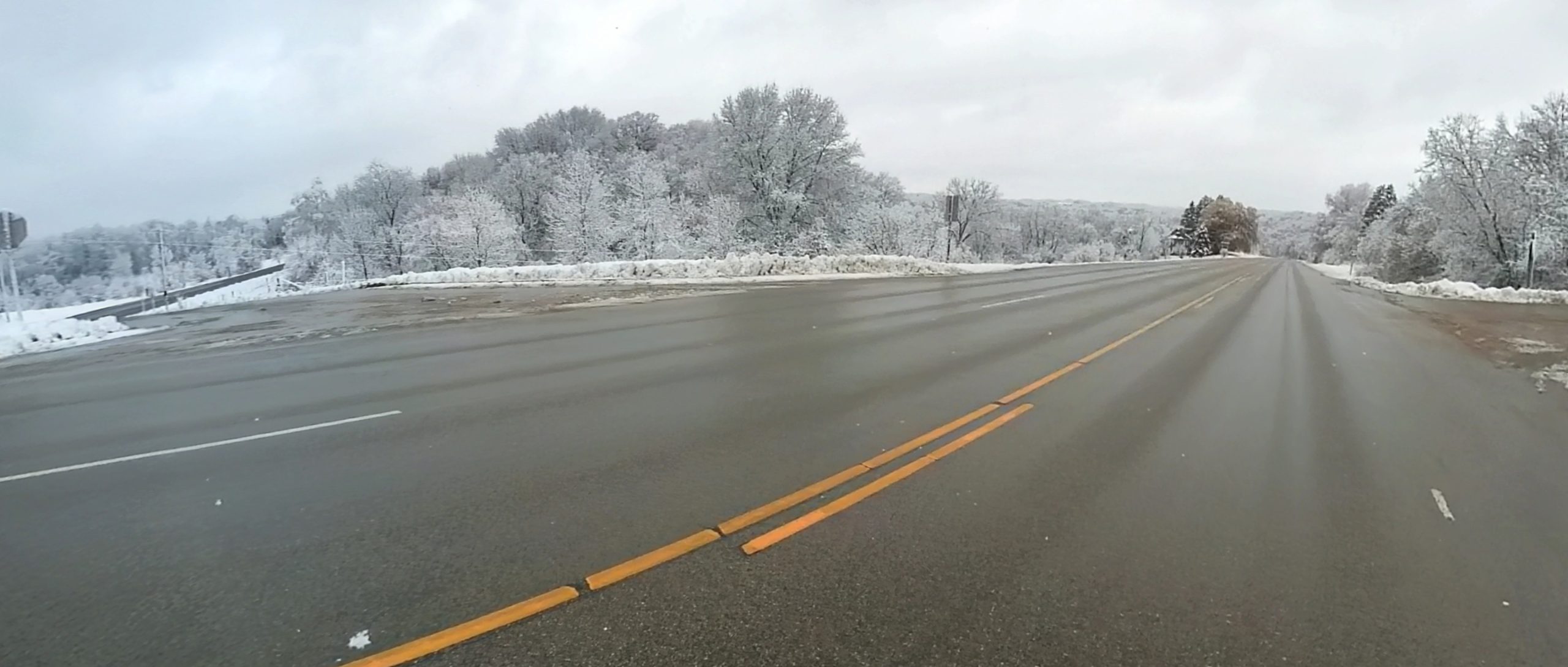
Main roads in Crawford County, such as US Highway 18 and State Highway 27, are maintained by the Wisconsin Department of Transportation and serve to connect the county to larger cities and neighboring states. They generally have a higher speed limit and are wider in width than county roads.

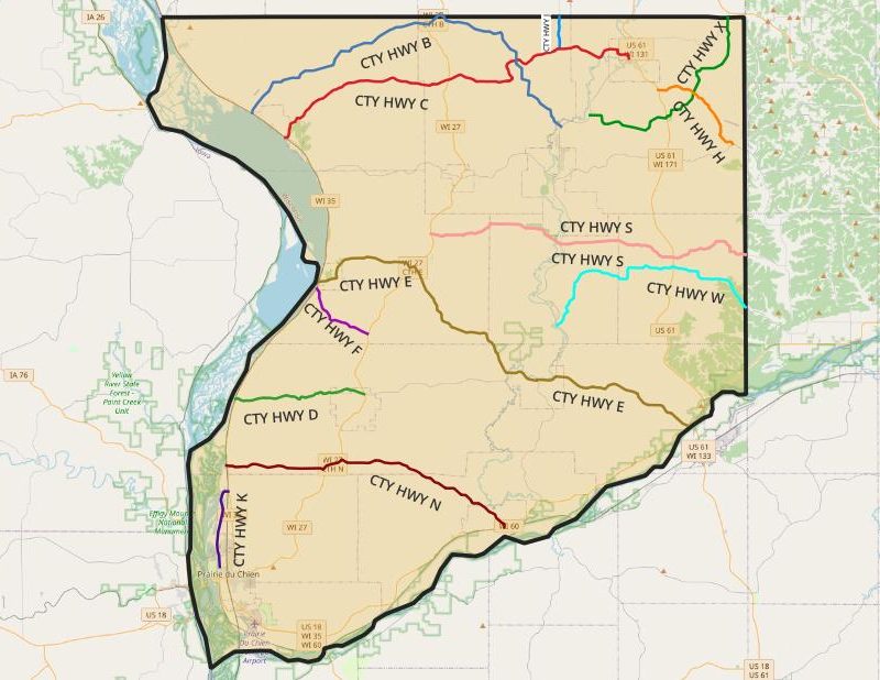
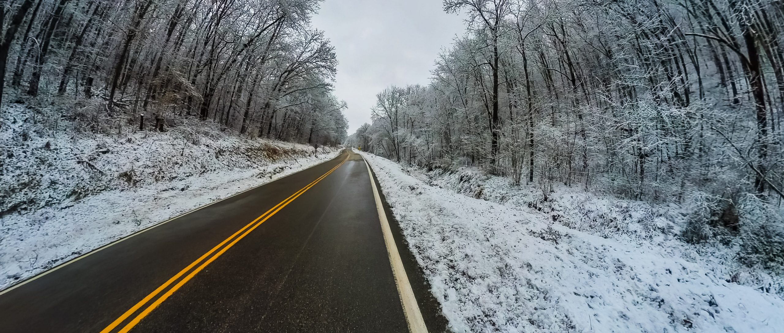
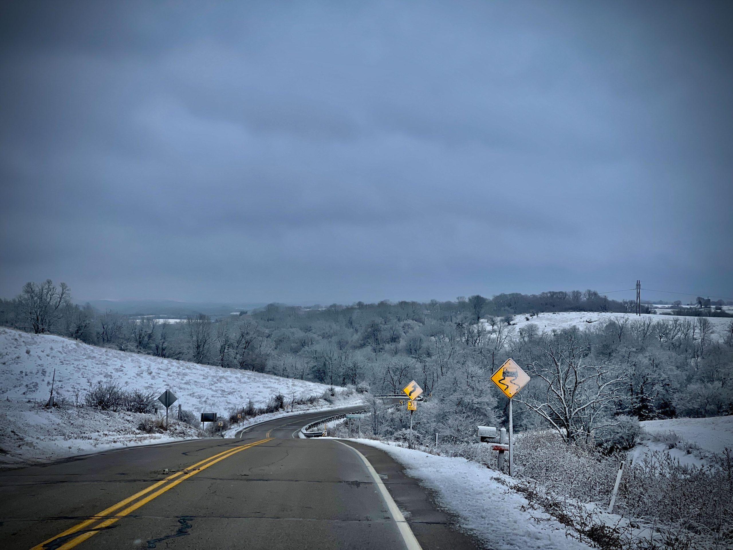
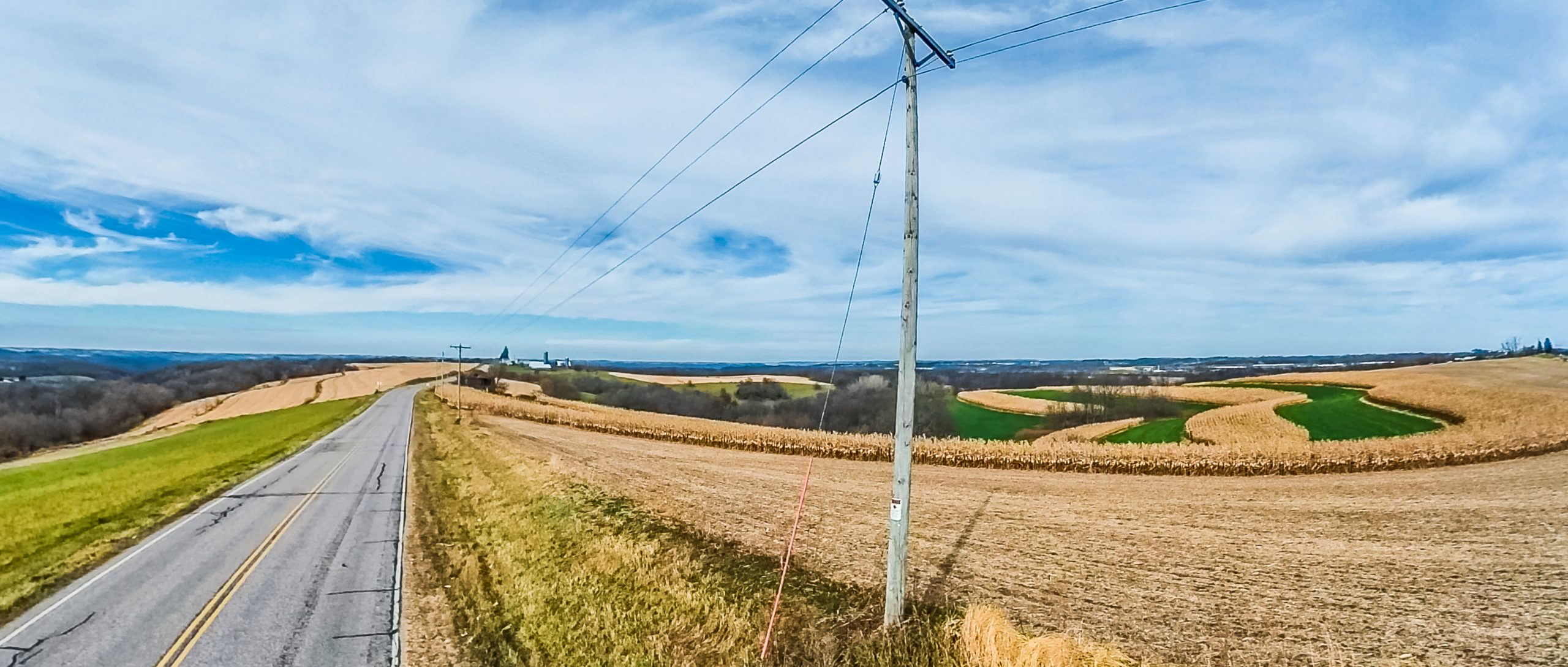
County roads in Crawford County, Wisconsin are typically maintained by the Crawford County Highway Department and serve to connect the smaller towns and rural areas within the county. They are typically smaller in width and have a lower speed limit than main roads. County roads are ideal for road touring.

Wisconsin State Highway 27 is a winding and turning scenic drive along the central ridgeline of the county. Highway 27 offers great views of Crawford County ridges and valleys and pastoral farmland, and even some glimpses in the distance to the west of the Mississippi River!

In the south, the road begins/ends as a junction with US 18, WI 60 and WI 35 in Prairie du Chien. It travels through Eastman, where it intersects with WI 179, then on through Seneca and Mount Sterling, where it intersects with WI 179. In the north, the road exits the county and continues north through the ridgetops of Vernon County.

Several county roads intersect ST HWY 27, including CTY HWY N, CTY HWY D, CTY HWY F, CTY HWY E, CTY HWY S, CTY HWY C, and CTY HWY B.

top

Wisconsin State Highway 35 enters the county in the south, crossing the Wisconsin River from Grant County and travels approximately 36 miles to Vernon County in the north.

With views of the Mississippi River on one side and gorgeous bluffs and goat prairies on the other, WI 35 earns it’s official name of “The Great River Road” and is a great day-trip drive.

In Prairie du Chien, 35 meets the western terminus of WI 27 at East Blackhawk Avenue. WI 35 continues north out of the city and runs along the Mississippi River’s east banks through Lynxville, past Lock and Dam Number 9 to intersect with WI 171 just outside of  Ferryville, which it also passes through.


Lock and Dam Number 9, Near Lynxville

About three miles south of De Soto, it intersects with the western segment of WI 82, which crosses over the Mississippi River into the city of Lansing, Iowa, while WI 35 continues across the Vernon County line.

Several county roads interest with ST HWY 35, including CTY HWY K, CTY HWY N, CTY HWY D, CTY HWY F, CTY HWY ECTY HWY C, and CTY HWY B.

A train passes below Sugar Creek Bluff Overlook near the Mississippi River
top

Wisconsin State Highway 60 begins on the Marquette-Joliet Bridge that crosses the Mississippi River from Iowa at Prairie du Chien, concurrent with US 18. The highway travels south out of the city and follows the Wisconsin River‘s northern bank, heading east through Wauzeka, where it intersects WI 131 and crosses the Kickapoo River as it enters the Wisconsin. It meets US 61 just outside of Boscobel, WI and travels concurrently for a short while before eventually leaving the county in the east, heading into Richland County.

The highway has been designated an official Scenic Byway by Wisconsin state government. Dubbed the “Lower Wisconsin River Road,” the road is a favorites for touring, with magnificent views of the Wisconsin River for much of its journey through Crawford County.

Two county roads intersect ST HWY 60: CTY HWY N and CTY HWY E.

top

U.S. Highway 61 is a major highway that extends 1,400 miles between New Orleans, Louisiana and the city of Wyoming, Minnesota! The highway generally follows the course of the Mississippi River and is designated the Great River Road for much of its route, however, in Crawford County the river moves away from the river. It enters from Vernon County in the north, passing through Soldiers Grove and along the ridge, where it intersects with WI 171, near the famous Gays Mills Apple Orchards, until it crosses the Wisconsin River into Grant County in the south, near Boscobel, WI.

Although a major US highway, the road rambles from valley to ridgetop and back to the river in Crawford County. It a beautiful drive and host to numerous small unincorporated communities, each with its own special character and a tavern or two!

It intersects with several county roads, including CTY HWY WCTY HWY S, CTY HWY H, CTY HWY X, and almost CTY HWY C in Soldiers Grove.

top

Scenic, rural and winding, Wisconsin Highway 131 follows the Kickapoo River for much of its length in Crawford County. The road is a great road trip and  rambles through farmland and wooded areas and through several towns, including Steuben, Bell Center, Gays Mills, and Soldiers Grove.

It begins at an intersection with WI 60 just northeast of Wauzeka. The highway heads northward from the intersection toward Steuben, then begins to follow the Kickapoo River here and it runs within the river’s valley through all of Crawford County. In Steuben it intersects with WI 179, WI 171 in Gays Mills and US 61 in Soldiers Grove, then continues to follow the Kickapoo River into Vernon County to the north.

The road passes several canoe landings and public hunting lands and offers possibilities for fishing from the banks or the Kickapoo or in one of the numerous parks that abut the river. There are opportunities for wetland birding along much of its length, particularly between Steuben and Bell Center.

This highway intersects numerous county roads, including CTY HWY E, CTY HWY W, CTY HWY S, CTY HWY B, CTY HWY X, and CTY HWY C.

top

Another great scenic and rolling drive, Wisconsin Highway 171 begins at an intersection with WI 35, along the Mississippi River. From there, it climbs eastward, into Mount Sterling, where it intersects WI 27. The highway then continues, dropping from the ridge down into the Kickapoo River valley at Gays Mills, where it intersects with WI 131. In Gays Mills, the highway curves up the famous “Orchard Hill” and into “Apple Country”, where it eventually intersects with US 61 before exiting the county as it enters Richland County.

This highway intersects only one county road, CTY HWY H, near where the eastern border of Crawford County.

top

An interesting and quick little scenic drive, Wisconsin Highway 179 connects the communities of Eastman and Steuben. The road winds from ridge to the Kickapoo River valley and terminates as it intersects with WI 131. A short 10 mile drive, full of turns and twists past farms and wooded land.

ST HWY 179 intersects with CTY HWY D just north of Eastman. Indeed, it used to be the eastern portion of that county road!

top

A short section of Wisconsin State Highway 82 enters Crawford County in De Soto, where it intersects with WI 35 and follows that route south for a few miles before turning and entering Iowa at Lansing, crossing the famous Blackhawk Bridge. Be sure to drive this bridge while you can, as there are plans to replace it in the coming years!

Image by Dukedauphin

top

A short section of US Highway 18 enters Crawford County in Prairie du Chien, crossing the Mississippi River on the Marquette-Joliet Bridge, where it then intersects with WI 35 and WI 60 and follows that route south for a few miles before turning and entering Grant County, crossing the Wisconsin River there.

Image by Jonathunder

top

A county highway running east-west in the northern portion of Crawford County, CTY HWY B begins in the west with a junction of ST HWY 35, along the banks of the Mississippi River, just north of Ferryville. It climbs up to the ridgetops and meets with ST HWY 27 just out of the northern edge of the county, then descends again, passing through the unincorporated community of Towerville, then on to an intersection with CTY HWY C in the unincorporated community of Star Valley. From Star Valley, CTY HWY B winds its way through the hills, crossing the Kickapoo River just before it meets with ST HWY 131, just north of Gays Mills.

top

A county highway running east-west in the northern portion of Crawford County, CTY HWY C begins in the west along the Mississippi River with a junction at ST HWY 35, just south of Ferryville. It climbs up to the ridgetops and meets with ST HWY 27 just north of the unincorporated community of Fairview. From the ridge, the road rolls through the pastoral countryside where it meets with CTY HWY J in the unincorporated community of Pine Knob, then gradually descends again to an intersection with CTY HWY B in the unincorporated community of Star Valley. From Star Valley, CTY HWY C winds its way through the hills and along the Kickapoo River just before it meets with ST HWY 131 in the village of Soldiers Grove.

top

A county highway running east-west in the central portion of Crawford County, CTY HWY D begins in the west along the Mississippi River at a junction with ST HWY 35 between Prairie du Chien and Lynxville. It ascends and winds up to the ridge and meets with ST HWY 27 and ST HWY 179 just north of Eastman.

Once upon a time, CTY HWY D continued on to Steuben, but that stretch is now ST HWY 179!

top

Prepare to see the rivers!

A county highway running east-west across the heart of Crawford County, CTY HWY E begins in the west along the Mississippi River with a junction at ST HWY 35, just north of Lynxville. It climbs up to the blufftops, granting views of the Mississippi and eventually meets with ST HWY 27 just south of Seneca, where it then winds and descends. It passes near both Crowley Park and Hogback Prairie State Natural Area then meets and joins ST HWY 179. It crosses the Kickapoo River just outside of Steuben where ST HWY 179 ends and joins ST HWY 131 for short stretch. The road then rises back to the ridge and winds through the pastoral countryside with distant views of the Wisconsin River valley, which it eventually descends to meet at a junction with ST HWY 60 near where it meets US HWY 61, just outside of Boscobel, WI.

top

A county highway running east-west in the central portion of Crawford County, CTY HWY F begins in the west along the Mississippi River at a junction with ST HWY 35 just to the south of Lynxville. It wends and winds up to the ridge giving great views of the Mississippi River. It eventually meets with ST HWY 27 just south of Seneca.

top

CTY HWY H is an interesting little rollick through northeast Crawford County. A relatively short road connecting US HWY 61 and ST HWY 171, the road begins in the west a few miles south of Soldiers Grove and winds its way through forested valleys, crossing CTY HWY X, then ending in the east where it meets WI ST HWY 171.

top

A short county highway running north-south in the north central portion of Crawford County, CTY HWY J begins in the south at a junction with CTY HWY C in the unincorporated community of Pine Knob. The road continues a short way into Vernon County as CTY HWY J. While short, the road offers plenty of views of the surrounding pastoral countryside as it runs the ridges.

top

Yet another chance to see the rivers!

A county highway running east-west across southern Crawford County, CTY HWY N begins in the west along the Mississippi River with a junction at ST HWY 35, just north of Prairie du Chien. It climbs up to the blufftops, granting views of the Mississippi and eventually rolls along to meet with ST HWY 27 just south of Eastman, where it then hugs the ridges and eventually descends to the Wisconsin River valley, meeting ST HWY 60 in Wauzeka.

top

A county highway running east-west in the east-central portion of Crawford County, CTY HWY S begins in the west just north of Seneca at a junction with ST HWY 27. It descends and follows a beautiful valley, crossing the Kickapoo River in the unincorporated community of Petersburg, where it intersects ST HWY 131.

The roads winds on and climbs back to intersect the rolling US HWY 61 corridor, then continues on, eventually becoming CTY HWY S in Richland County.

top

A county highway running east-west in the east-central portion of Crawford County, CTY HWY W begins in the west in the unincorporated community of  Barnum, right on the banks of the Kickapoo River. It ascends the picturesque hills to intersect US HWY 61, then continues on, becoming CTY HWY W, where it intersects shortly thereafter with ST HWY 60 just into Richland County.

top

A unique little curlycue of a road in northeastern Crawford County, CTY HWY X begins in the southwest near North Crawford Schools at an intersection with ST HWY 131 near picturesque wetlands on the Kickapoo River. The road explores its way through the hills and eventually rises to meet US HWY 61 north of the unincorporated community of Rolling Ground.

The road then turns northeasterly and heads off through Amish country, eventually intersecting with US HWY 14 just into Vernon County.

top

A tiny but mighty county highway, County Highway K begins life at its southern end as North Main Street in Prairie du Chien. It passes by historic Cavalry Cemetery and heads north out of town along the Mississippi River, parallel to WI 35. It passes by lots of The road runs close to the Mississippi River and especially during spring and fall migration, lots of birds are visible, including bald eagles and pelicans galore. Toward the northern end of the road, where it meets WI 35, you can take Ambro Road to get to two MIssissippi River boat landings, one offering access to Gremore Lake, the other to Ambro Slough, where there is a canoe/kayak trail. You can also gawk a little at all of the stilt houses and also get a closer look at the birds!

top